


loading…
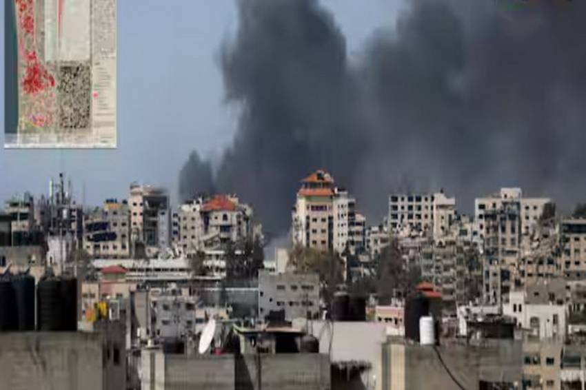
Khan Yunis and Gaza experienced the most significant increase in damage. (Photo: Reuters)
JAKARTA – The United Nations Satellite Center (UNOSAT) released a satellite image of the Gaza Strip. Many changes can be seen in several areas affected by the war between Israel and Hamas.
This latest analysis based on satellite imagery states that around 35 percent of buildings in the Gaza Strip have been damaged since the conflict began. The war between Israel and Hamas began when the Islamist group launched an unprecedented October 7 attack on Israel, resulting in the deaths of around 1,200 people, mostly civilians, according to official figures released by Israel.
The Wionews page, Friday (22/3/2024) reported that UNOSAT's analysis was based on very high resolution satellite imagery collected since February 29 2024. This image revealed a significant increase in damage compared to previous assessments.
UNOSAT compared this image with other images dated 1 and 10 May 2023; September 18, 2023; October 15, 2023; November 7 and 26, 2023; and January 6 and 7, 2024.
The report states that 35 percent of buildings in the Gaza Strip have been damaged. This percentage represents 88,868 buildings, of which 31,198 have been identified as destroyed. A total of 16,908 were seriously damaged, and 40,762 were moderately damaged.
“This represents an increase of almost 20,000 damaged buildings compared to the previous assessment carried out in January 2024,” the report said.
According to the UNOSAT report, Khan Yunis and Gaza have experienced the most significant increase in damage. In the Khan Yunis area, 12,279 buildings were seen damaged and in Gaza, 2,010 buildings were seen damaged. Specifically for Khan Yunis City, there were 6,663 buildings that had just been demolished.
“Beyond the number of damaged buildings, this update provides an estimate of 121,400 housing units affected by damage in the Gaza Strip,” wrote the UNOSAT report.
(msf)
