


loading…
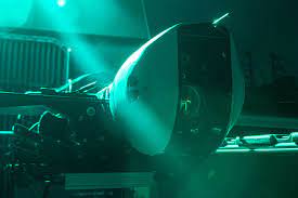
Iran uses the INS navigation system. photo/ Tehran News
TEHERAN – It has been revealed that Iran’s territorial defense is strong, making it difficult for enemies to penetrate because it uses the Inertial Navigation System (INS). Navigation that uses computer sensors, motion (accelerometers) and rotation sensors.
Iran uses this technological system in its latest long-range missile nicknamed Kheibarshekan or castle destroyer. The range of this missile is said to be able to reach Israeli territory.
Iran developed an inertial navigation system (INS) to improve aircraft navigation accuracy. The INS uses inertial sensors to measure the aircraft’s rotation and acceleration, and then uses this information to calculate the aircraft’s position.
INS is more accurate than GPS-based navigation systems alone, because it does not rely on GPS signals which can be disrupted by weather.
Iran has developed the INS for use in fighters, helicopters and drones. Iran’s INS is thought to have comparable accuracy to Western-made INS.
Iran’s development of the INS is part of its efforts to increase its military capabilities. INS can be used to improve the accuracy of air strikes and to increase the aircraft’s ability to operate in adverse weather conditions.
Here are some details about Iran’s inertial navigation system:
1. Iran’s INS uses inertial sensors consisting of a gyroscope and accelerometer.
2. The gyroscope measures the rotation of the aircraft, and the accelerometer measures the acceleration of the aircraft.
3. Information from inertial sensors is used to calculate the aircraft’s position.
4. Iran’s INS is estimated to have comparable accuracy to Western-made INS.
5. Iran’s INS is used in fighters, helicopters and drones.
6. Iran’s INS development is part of Iran’s efforts to increase its military capabilities.
This technology is used in vehicles such as ships, airplanes, submarines, missiles and spacecraft.
